Indonesian Coastal Zone
This blog provides pictures of the Indonesia Archipelago coastal zone.
About Me

- Name: Wahyu Budi Setyawan
- Location: Jakarta, Indonesia
I'm a researcher of Research Center for Oceanography, Indonesian Institute of Sciences. My activities in the institution have made me come to many parts of Indonesia. Using this blog, I'd like to share with you what I've seen, particularly in the coastal zones.
Tuesday, December 19, 2006
Thursday, September 07, 2006
Geureutee Rockycoast, Aceh Westcoast

Photo 1. Geureutee Rockycoast, Aceh Westcoast. The white stripe at the foot of the mountain is the imprint of the 26 December 2004 tsunami. Taken in August 2006.
Regards,
Wahyu
Friday, July 28, 2006
Tuesday, July 04, 2006
Java Southern Coast, Pacitan, Watukarung
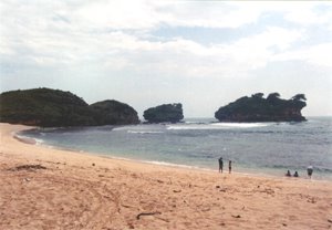
Photo 1. The coast of Watukarung, Pacitan, Central Java that show stack and headland of reef limestones, and sandy beach of carbonate sand. The coast has coastal platform, and high of berm surface from mean sea level is about 2 meters. There are notch at the lower part of the stack and headland. Photo: from Author, Januari 2006.
Regards,
Wahyu
Saturday, May 06, 2006
How often Tsunami in Indonesia?
In periods of 1990-2006, 10 tsunami have occured in Indonesia. The map (Figure 1) shows the distribution of the tsunamis.

Sunday, April 23, 2006
North Coast of Banten 1, Tanjung Pontang - Lontar: erosional coastline
 Figure 1. Site map of Tanjung Pontang (west) - Tanjung Kait (east). Large black number indicates relative location the photos. Laut = sea, tanjung = cape, pulau = island.
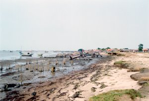 Photo 1. Face to east toward Lontar village. Erosional coast with erosional platform of stiff mud.

Photo 2. Face to west. Eroded mangrove coast at Lontar.
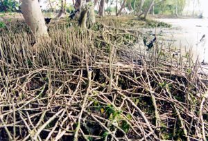 Photo 3. "Net" of mangroves roots that have lost their substrate.
There are only uncontinuous narrow strip of mangrove along the coast. The villagers have developed ponds extensively at coastal plain and left only about 10 meters mangrove along the coast (Photo 4). At many parts of the coast, the mangroves was eroded away and the ponds as well (Photo 5).
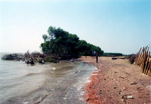 Photo 4. Face to east. Narrow mangrove strip near Tanjung Pontang. Sea wave have eroded away some part of the mangrove and the ponds embankment as well.
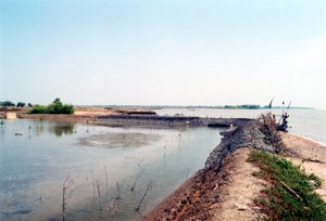
Photo 5. Face to west. Eroded ponds that cause zigzagged coastline.
Regards,
Wahyu
Friday, April 07, 2006
Biak Island in Pictures 01
![]()
Figure 1. Image of eastern Biak island.
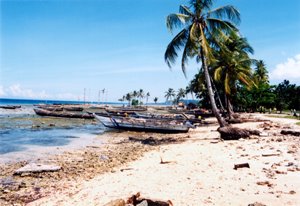 Photo 1. Face to west. The long boats are transportation fasility to Padaido islands.
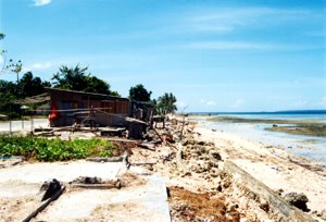 Photo 2. Face to east. The foundation and floor of the swept away houses by the 1996 tsunami.
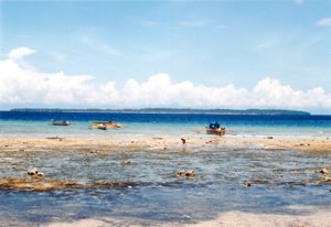
Photo 3. Face to south. Coastal platform/reef flat in foregroung and reef island at background. Depth of the blue water is more than eight hundred meters.
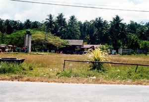
Photo 4. Face to north. Bosnik market where peoples from Padaido islands trade their goods, mainly fisheries products. Before the 1996 tsunami, Bosnik subdistrict capital was here.
Regards,
Wahyu


