

Biak Island in Pictures 01
Biak is Pacific island of Indonesia. The island was very important during Second Worl War. In October 2003, I came to the island for the third time. I came to Bosnik where a capital of Bosnik Subdistrict situated before the Biak Tsunami in 1996. The tsunami devastated the town. The following in the pictutes of Bosnik coastal area. I stood at a point at Bosnik's coastline, turned my body around and took the pictures.
![]()
Figure 1. Image of eastern Biak island.
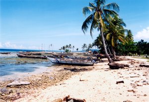 Photo 1. Face to west. The long boats are transportation fasility to Padaido islands.
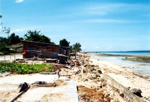 Photo 2. Face to east. The foundation and floor of the swept away houses by the 1996 tsunami.
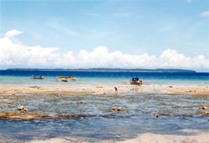
Photo 3. Face to south. Coastal platform/reef flat in foregroung and reef island at background. Depth of the blue water is more than eight hundred meters.
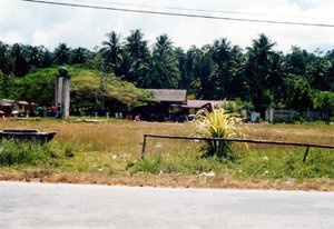
Photo 4. Face to north. Bosnik market where peoples from Padaido islands trade their goods, mainly fisheries products. Before the 1996 tsunami, Bosnik subdistrict capital was here.
Regards,
Wahyu
posted by Wahyu Budi Setyawan | Friday, April 07, 2006
![]()
0 Comments:
Post a Comment
<< Home