
North Coast of Banten 1, Tanjung Pontang - Lontar: erosional coastline
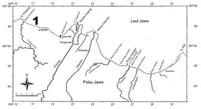 Figure 1. Site map of Tanjung Pontang (west) - Tanjung Kait (east). Large black number indicates relative location the photos. Laut = sea, tanjung = cape, pulau = island.
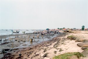 Photo 1. Face to east toward Lontar village. Erosional coast with erosional platform of stiff mud.
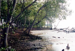
Photo 2. Face to west. Eroded mangrove coast at Lontar.
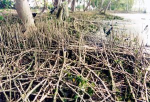 Photo 3. "Net" of mangroves roots that have lost their substrate.
There are only uncontinuous narrow strip of mangrove along the coast. The villagers have developed ponds extensively at coastal plain and left only about 10 meters mangrove along the coast (Photo 4). At many parts of the coast, the mangroves was eroded away and the ponds as well (Photo 5).
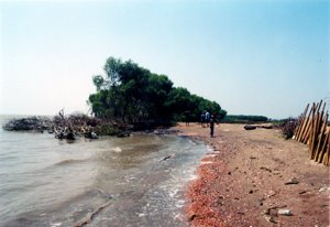 Photo 4. Face to east. Narrow mangrove strip near Tanjung Pontang. Sea wave have eroded away some part of the mangrove and the ponds embankment as well.
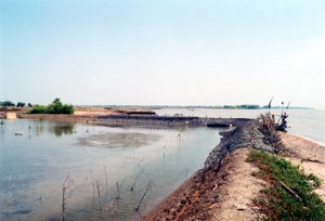
Photo 5. Face to west. Eroded ponds that cause zigzagged coastline.
Regards,
Wahyu
posted by Wahyu Budi Setyawan | Sunday, April 23, 2006
|
0 comments
![]()
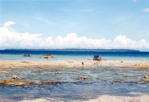
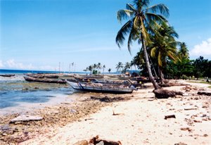 Photo 1. Face to west. The long boats are transportation fasility to Padaido islands.
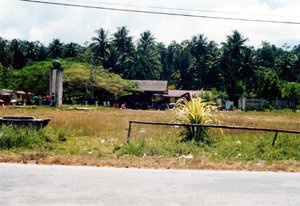
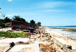 Photo 2. Face to east. The foundation and floor of the swept away houses by the 1996 tsunami.